FTC disclaimer: This post contains affiliate links and I will be compensated if you make a purchase after clicking on my link.
In today’s world, managing land well is key for property care, resource use, and protecting the environment. The best land management software has many tools. These help with tasks like mapping, tracking leases, automating workflows, and using data for better decisions.
But what makes the top land management software stand out? How can you pick the right one for your needs? Get ready to learn about the 11 best land management software options. We’ll give you detailed info on each, including their main features and costs.
Are you ready to use land management technology to improve your operations? Let’s look at the advanced tools that are changing how we handle our natural resources.
Key Takeaways
- Modern land management software solutions are usually web-based apps with cloud storage and live maps.
- Important features include managing land records, GIS mapping, tracking leases, managing tax records, and integrating with accounting. It also has workflow automation and reporting tools.
- Land management software helps many users, like landowners, farmers, ranchers, conservationists, and government officials.
- Choosing the right land management software means looking at its features, how easy it is to use, its price, and how well it integrates with other systems.
- Using the right land management software can make your operations smoother, better use resources, and help the environment.
Introduction to Land Management Software
Property management systems, acreage tracking solutions, and parcel mapping applications are key for land use. They help manage land well, make operations smoother, and improve decision-making.
What is Land Management Software?
Land management software helps manage land data and activities. It’s a central place for land ownership, leases, taxes, and more. It makes data accurate, improves teamwork, cuts down on paperwork, and saves money.
Why Use Land Management Software?
- Improved data accuracy and organization
- Enhanced collaboration and communication among stakeholders
- Streamlined workflow and reduced administrative workload
- Cost savings through efficient land management practices
- Compliance with regulatory requirements and legal obligations
Key Features to Look For
When looking at land management software, check these features:
- Land record management: Stores and organizes land documents and contracts.
- GIS mapping: Uses GIS for visualizing and analyzing land.
- Lease and tenancy tracking: Manages lease agreements and tenant info.
- Tax records management: Tracks tax payments and compliance.
- Accounting and financial integration: Includes financial tools for budgeting and invoicing.
- Workflow automation: Automates tasks like inspections and maintenance.
- Reporting and analytics: Offers detailed reports and insights for decision-making.
Land management software is a powerful tool for landowners and others. It boosts efficiency, land use, and follows rules and best practices.

1. Trimble Land Administration
Trimble Land Administration helps manage land efficiently. It uses Geospatial Analysis Tools and Land Asset Management Platforms. This software works well with Peloton Map, making it easy to see and understand land data.
It has many features. These include managing contracts, leases, and titles. It also tracks payments and reports on land area. Plus, it handles royalties, wells, and joint ventures.
Overview of Trimble
Trimble is a big name in positioning technologies. It focuses on the natural resources industry. In 2021, it made USD 3.6 billion in sales.
It has over 12,000 employees worldwide. More than 3,000 work on Research and Development. Trimble has been around for over 40 years and is listed on NASDAQ (TRMB).
Key Features
- Comprehensive contract management
- Mineral and surface lease management
- Intuitive title chain visualization
- Obligations and payments tracking
- Detailed acreage reporting
- Robust royalty management
- Well and facilities tracking
- Units, pooling, and joint ventures management
- Seamless integration with Peloton Map for spatial analysis
Pricing Information
Trimble Land Administration has different pricing plans. The cost depends on what you need and how big your operation is. If you’re interested, contact the Trimble sales team for a quote.

2. ESRI ArcGIS
ESRI ArcGIS is a strong GIS mapping software used a lot in land management. It lets users see, analyze, and understand data. This helps them spot patterns and trends. ArcGIS works on the cloud, desktop, and mobile for data collection.
Overview of ESRI ArcGIS
ESRI ArcGIS is a top Cadastral Mapping Solutions platform. It has been a key player in GIS for years. It has many tools for managing and analyzing land, property, and infrastructure data.
Benefits for Users
- It has an easy-to-use interface for mapping and analysis.
- It handles a lot of data formats well.
- It has advanced tools for finding patterns and trends in land data.
- It works well with other ESRI products and third-party software.
- It has mobile and cloud solutions for collecting data anywhere and anytime.
System Requirements
To use ESRI ArcGIS well, you need a computer with certain specs:
| Operating System | Processor | RAM | Storage |
|---|---|---|---|
| Windows 10 or later | Intel Core i5 or equivalent | 8 GB or more | 20 GB or more of available space |
You also need a good display and a graphics card with 2 GB of memory. This is for working with big data and complex visuals.
3. LandPro
LandPro is a top choice for land management software. It’s easy to use and has everything small to medium-sized operators need. It’s been around since 1990, helping the oil, gas, and mining industries for over 29 years.
Key Features
LandPro has many features. It can make over 280 reports on land management. This includes acreage inventories and payment reports. It also has tools for mapping and GIS data.
User Experience
LandPro was made by land experts for land experts. It’s easy to use, making land management simple. Companies like Pettigrew & Pettigrew Land Services say it works well with other software, boosting productivity.
Pricing Plans
LandPro has affordable plans for small operations. It saves money and time. Users like how it keeps accurate records for daily work.
“LandPro has been an invaluable tool for our land management needs. The user-friendly interface and comprehensive features have streamlined our workflows and helped us make more informed decisions.”
4. LandFolio
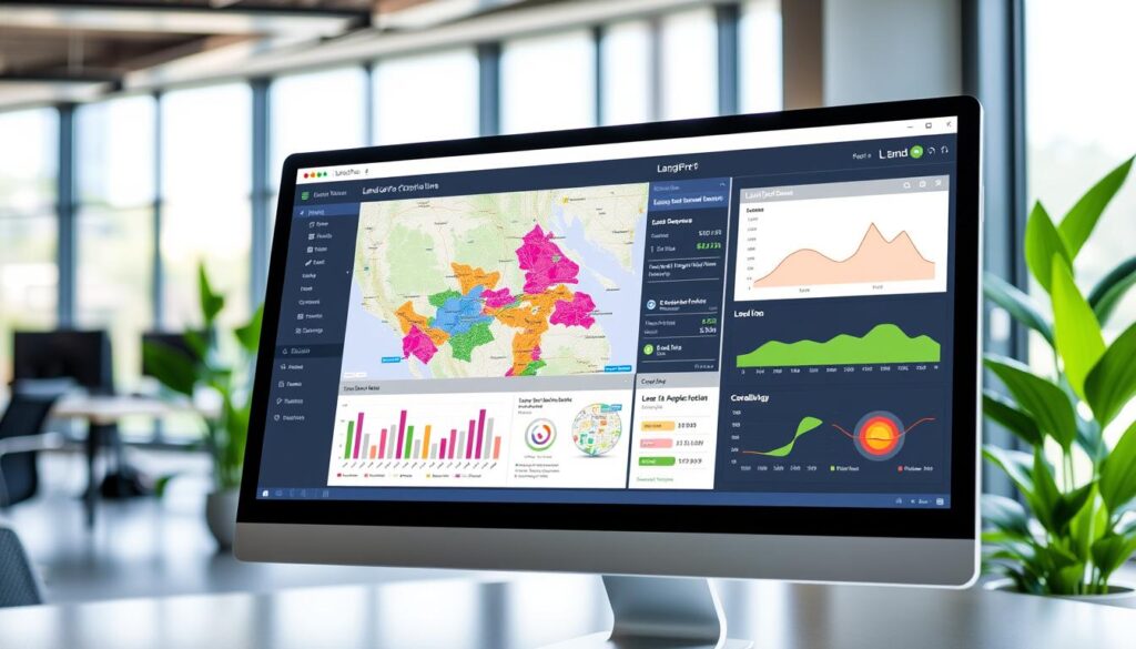
LandFolio is a strong Land Asset Management Platform. It has many tools for managing land, natural resources, and property rights. It’s made for big government agencies and land management groups. It helps with land records, mapping, and property deals.
Overview of LandFolio
LandFolio is among the top land management software. It has a full Esri ArcGIS server for easy Parcel Mapping. It helps government agencies work well in land management, like legal, rules, money, and customer service.
Best Use Cases
LandFolio is a digital land registry for government. It makes managing land ownership and interests safe and clear. It records things like mortgages and easements, making it easier to manage documents.
Customer Support Options
LandFolio’s cadastre and registry help modernize land title systems. It makes getting land info faster and easier. It also lets people search for property and see land info online. It keeps land records safe from disasters.
“LandFolio is an excellent and unbeatable tool for controlling legal deadlines,” – Glencore Land Manager.
LandFolio has been used for over 10 years. It’s strong and reliable. It’s trusted by top mining and exploration companies and government agencies. It helps manage complex land and mineral rights.
5. Easy Land
Easy Land is a land management software that’s easy to use. It has a simple design for small to medium-sized businesses and landowners.
Visual Interface of Easy Land
Easy Land’s interface is both intuitive and nice to look at. It’s designed to make managing land data easy for everyone. The layout is clean, so even beginners can get started quickly.
Important Features
Easy Land has many features to help with land management. These include:
- Parcel Mapping: It lets users see their land parcels and track changes.
- Lease Management: Easy Land makes managing leases easy with tools for tracking and payments.
- Reporting Tools: It helps users create detailed reports on their land and leases.
Target Audience
Easy Land is for small to medium-sized businesses and landowners. It’s easy to use and focuses on the basics of land management. This makes it perfect for those who want to simplify their land operations.
Easy Land is a great choice for Land Mapping Tools and Property Management Systems users. It offers a simple yet effective way to manage land.
6. EcoReal Estate Software
EcoReal Estate Software is a top choice for Terrain Modeling Software and Land Asset Management Platforms. It focuses on sustainability and caring for the environment. This platform helps track and manage eco-friendly land use, energy efficiency, and conservation efforts.
Overview of EcoReal Estate
EcoReal Estate, also known as CIMBEL, is a land management software. It puts sustainability and environmental impact first. The platform works with many sustainability tools. It gives detailed reports on environmental performance, like carbon emissions and resource use.
Sustainability Features
- Comprehensive tracking and management of eco-friendly land use practices
- Integration with renewable energy systems and energy-efficient building technologies
- Detailed reporting on environmental impact, including carbon footprint and resource conservation
- Compliance monitoring and support for sustainable land management regulations
Integration Capabilities
EcoReal Estate Software works well with many leading tools and platforms. This makes land management easier and gives a full view of sustainability efforts. It connects with GIS systems, energy management platforms, and more for better land asset management.
| Feature | Benefit |
|---|---|
| Terrain Modeling | Accurate representation of land topography for better planning and decision-making |
| Renewable Energy Integration | Seamless incorporation of solar, wind, and other clean energy sources |
| Environmental Compliance Tracking | Ensure adherence to local, state, and federal regulations |
| Sustainability Reporting | Detailed analytics on environmental impact and progress towards sustainability goals |
Using EcoReal Estate Software changes how land managers and real estate pros work. They focus more on sustainability and caring for the environment. This doesn’t mean they lose out on being efficient and making money.
7. Basecamp Land Management
Basecamp Land Management is a top project management tool. It’s great for land management projects. It has features for teamwork, task management, and sharing documents.
Benefits of using Basecamp
Users love Basecamp for its easy-to-use design. They say it makes them more productive and less prone to mistakes. This leads to happier clients.
Basecamp helps businesses finish tasks faster. It has tools for scheduling, sharing files, and tracking projects. This improves how well teams work together.
User Feedback
Over 75,000 organizations use Basecamp in 166 countries. They love it for making work easier and faster. Top marketers and designers also recommend it.
Pricing and Plans
Basecamp has plans for all sizes of businesses. It’s perfect for Property Management Systems and Acreage Tracking Solutions. It’s a favorite among land management pros.
| Feature | Rating | Number of Reviews |
|---|---|---|
| Collaboration Tools | 4.4 | 924 |
| Project Planning/Scheduling | 4.2 | 401 |
| Task Scheduling | 4.5 | 114 |
| File Sharing | 4.4 | 655 |
| Task Management | 4.4 | 961 |
| Communication Management | 4.4 | 139 |
| Reporting/Project Tracking | 4.3 | 837 |
| Mobile Access | 4.2 | 114 |
| Alerts/Notifications | 4.4 | 110 |
| Prioritization | 4.0 | 278 |
| Discussions/Forums | 4.5 | 95 |
| Idea Management | 4.2 | 408 |
| Milestone Tracking | 4.0 | 277 |
| Percent-Complete Tracking | 4.0 | 297 |
“Basecamp has streamlined organization and efficiency for our business, resulting in clearer communication and better collaboration among our team.”
8. AccuLand
AccuLand is a top land mapping tools and cadastral mapping solutions software. It’s known for its high accuracy in mapping land boundaries, calculating areas, and tracking ownership. It has advanced features and works well with surveying equipment, making it a great choice for land management pros.
Overview of AccuLand
AccuLand focuses on accurate and reliable land mapping. It uses the latest tech, like GPS and surveying tools, for precise data capture. Its easy-to-use interface and workflow make it popular among land management experts.
Unique Selling Points
- High-precision land boundary mapping and area calculation
- Seamless integration with surveying equipment for data import and analysis
- Comprehensive land ownership tracking and title management
- Advanced reporting and data visualization tools
- Efficient land parcel management and workflow optimization
Getting Started with AccuLand
AccuLand makes it easy for new users to start. It offers detailed guides, tutorial videos, and quick customer support. Plus, it has flexible licensing options for all land management groups.
| Feature | Description |
|---|---|
| Precision Mapping | AccuLand’s advanced GPS and surveying integration enables highly accurate land boundary mapping and area calculation. |
| Ownership Tracking | The software’s comprehensive land title management features allow users to efficiently track and manage property ownership details. |
| Reporting and Analytics | AccuLand provides powerful data visualization and reporting tools, enabling users to generate detailed reports and make data-driven decisions. |
AccuLand is great for land surveyors, urban planners, and natural resource managers. Its land mapping tools and cadastral mapping solutions make land management easier and more accurate.
Conclusion: Choosing the Right Software for Your Needs
When picking the best land management software, think about a few things. Look at the size and complexity of your land. Also, think about the features you need, your budget, and if it works with your systems.
Factors to Consider
Look for a software with strong GIS mapping and lease management tools. It should also have good reporting and analytics. Plus, it should be easy to use. Make sure it works well with your other business tools to make things more efficient.
Final Thoughts on Land Management Solutions
The right software can really help your business. It lets you use land better, manage risks, and make smart choices. With the market growing, it’s important to pick the best fit for your needs.


